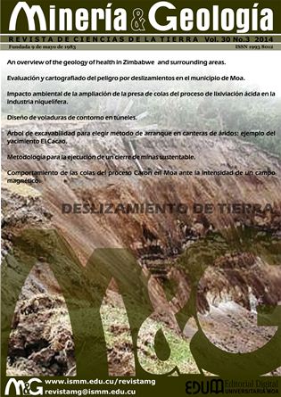
Landslide risk assessment and mapping of Moa
Keywords:
risk management, cartography, landslide risk, territorial organization, GIS, Moa.Abstract
The occurrence of landslides in Moa poses a serious threat to the industry, communities, socio-economic activities and the environment. The objective of this research is to assess and map the risks generated by the occurrence of landslides in the area by applying the Geographic Information Systems (GIS). For a methodological guidance, the guideline dated 2012 prepared by the National Risk Management Group was used to conduct the landslide hazard, vulnerability, risk analysis on the ground. As a result, this work produced a map indicating the overall landslide dangerousness in Moa on a 1:100 000 scale. This map is one more risk management and mitigation tool in the territorial organization.Downloads
References
BAEZA, C. 1994. Evaluación de las condiciones de rotura y la movilidad de los deslizamientos superficiales mediante el uso de técnicas de análisis multivariante. Tesis doctoral. Departamento de Ingeniería del Terreno y Cartográfica ETSECCPB-UPC.
BOSI, C. 1984. Considerazioni e proposte metodologiche sulla elaborazione di carte di stabilita. Geol. Appl. Ed Idrogeol 13: 246-281.
CARRARA, A. 1983a. Multivariate models for landslide hazard evaluation. Math. Geology 5: 403-426.
CARRARA, A. 1983b. Geomathematical assessment of regional landslide hazard. In: 4th Int. Conf. Applic. Stat. Porbabil. In Soil and Estruct. Eng. Firenze. 3-27 p.
CARRARA, A.; CARDINALI, M.; GUZZETTI, F. & REICHENBACH, P. 1995. GIS-based techniques for mapping landslide hazard. In: CARRARA, A. & GUZZETTI, F. (Eds.). Geographical Information Systems in Assessing Natural Hazards. Kluwer Academic Publications, Dordrecht, p. 135–176.
CHUNG, C. F. & FABBRI, A. G. 1993. The representation of geoscience information for data integration. Nonrenewable Resources 2(2): 122-139.
CHUNG, C. F. & LECLERC, Y. 1994. A quantitative technique for zoning landslide hazard. In: Int. Ass. Math. Gol. Annual Conf. Mont Tremblant, Quebec, Canada, 3-5, 87-93 p.
CHUNG, C. F.; FABBRI, A. G. & VAN WESTEN, C. J. 1995. Multivariate regression analysis for landslide hazard zonation. In: CARRARA, A. & GUZZETTI, F. (Eds). Geographical Information Systems in Assessing Natural Hazards. Kluwer Academic Publishers, 107-133 p.
COROMINAS, J. 1987. Criterios para la confección de mapas de peligrosidad de movimientos de ladera. Riesgos Geológicos. Serie Geología Ambiental. IGME, Madrid, 193-201 p.
CRUDEN, D. M. & VARNES, D. J. 1996. Landslide types and processes. In: TURNER, A. K. & SCHUSTER, R. L. (Eds.). Landslides, Investigation and Mitigation. Transportation Research Board, Special Report 247, Washington D.C., 36–75 p.
DHAKAL, S.; AMADA, T. & ANIYA, M. 2000. Databases and Geographic Information Systems for Medium Scale Landslide Hazard Evaluation: an Example from Typical Mountain Watershed in Nepal. En: BROMHEAD, A. E.; DIXON, N. & IBSEN, M. L. (Eds). Landslides in research, theory and practice. Tomas Telford, London, 1: 457-462 p.
GRUPO NACIONAL DE EVALUACIÓN DE RIESGOS. 2012. Guía metodológica para el estudio de peligro, vulnerabilidad y riesgo por deslizamientos de terreno a nivel municipal. Agencia Nacional de Medio Ambiente. CITMA. La Habana, p.31
HANSEN, A. 1984. Landslide hazard analysis. In: BRUNDSEN, D. & PRIOR, D. B. (Eds.). Slope Stability. John Wiley and Sons, 523-602 p.
HANSEN, A. & FRANKS, C. A. M. 1991. Characterization and mapping of earthquake triggered landslides for seismic zonation. Proceeding of IV. Int. Conf. Seismic Zonation. Stanford, California, 149-195 p.
HARTLÉN, J. & VIBERG, L. 1988. Evaluation of landslide hazard. In: BONNARD, CH. (Ed): Proceedings of 5th. International Congress on Landslides. Lausanne, 2: 1 037-1 057.
HECKERMAN, D. 1986. Probabilistic interpretation of MYCIN’s certainty factors. In: KANAL, L. N. & LEMMER, J. F. (eds.) Uncertainty in Artificial Intelligence. Elsevier, p. 167-196.
HUTCHINSON, J. N. 1988. Morphological and geotechnical parameters of landslides in relation to geology and hydrogeology. In: BONNARD, CH. (Ed.). Proceedings of 5th Int. Congr. on Landslides. Lausanne, 1: 3-35.
IAEG. 1976. Engineering geological maps. A guide to their preparation. International Association of Engineering Geologists. The UNESCO Press, Paris, 79 p.
IRIGARAY, C. 1995. Movimientos de ladera: inventario, análisis y cartografía de susceptibilidad mediante un Sistema de Información Geográfica. Aplicación a las zonas de Colmenar (Málaga), Rute (Córdoba) y Montefrío (Granada). Tesis doctoral. Universidad de Granada.
JONES, F.O.; EMBODY, D. R. & PETERSON, W.C. 1961. Landslides along the Columbia river valley, Northeastern Washington. U.S. Geol. Surv. Prof. Paper 367, 98.
LOMTADZE, V. D. 1977. Geología aplicada a la ingeniería. Geodinámica aplicada a la ingeniería. Pueblo y Educación, La Habana, 560 p.
LUCINI, P. 1973. The potential landslides forecasting of the Argille Varicolori Scagliose complex in IGM 174 IV SE Map, Saviano di Puglia (Compania). Geol. Appl. Idrogeol. 8: 311-316.
LUZI, L. & FABBRI, A. G. 1995. Application of Favourability Modelling to Zoning of Landslide Hazard in the Fabriano Area, Central Italy. In: 1st. Joint European Conference and Exhibition on Geographical Information. The hague, NL. 398-403 p.
MAHDAVIFAR, M. R. 2000. Fuzzy information Processing in Landslide Hazard Zonation and Preparing the Computer System. In: BROMHEAD, A.E.; DIXON, N. & IBSEN, M. L. (Eds). Landslides in research, theory and practice. Tomas Telford, London, 2: 993-998.
MORA, S. & VAHRSON, W. G. 1993. Determinación "a priori" de la amenaza de deslizamientos utilizando indicadores morfodinámicos. Tecnología ICE 3: 32-42.
MORA, S. & VAHRSON, W. G. 1994. Macrozonation methodology for landslide hazard determination. Bull. Of the Assoc. Eng. Geology. XXXI(1): 49-58.
MORGAN, B. W. 1968. An introduction to Bayesian statistical decision process. Prentice-Hall, New York, 116 p.
MULDER, H. F. H. M. 1991. Assessment of landslide hazard. Nederlandse Geografische Studies PhD Thesis, University of Utrecht, 150 p.
NEULAND, H. 1976. A prediction model for landslips. Catena 3: 215-230.
RENGERS, N.; SOETERS, R. & VAN WESTEN, C. J. 1992. Remote sensing and GIS applied to mountain hazard mapping. Episodes. 15(1): 36-45.
RODRÍGUEZ, A. 1998. Estudio morfotectónico de Moa y áreas adyacentes para la evaluación de riesgos de génesis tectónica. Tesis doctoral. Instituto Superior Minero Metalúrgico, Cuba.
SHAFER, G. 1976. A Mathematical Theory of Evidence. Princenton University Press, Princenton N. J., 297 p.
STEVENSON, P. C. 1997. An empirical method for the evaluation of relative landslip risk. Bul. AEG. 16: 69-72.
VAN WESTEN, C. J. 1993. Application of Geographic Information System to landslide hazard zonation. ITC-Publications nº 15, Enschede, 45 p.
VARNES, D. J. 1978. Slope movement tyoes and processes. En: Landslides analysis and control. Special Report. 176: 11-33.
VARNES, D. J. & IAEG. 1984. Landslide Hazard Zonation: a review of principles and practice. UNESCO, Darantiere, 61 p.
ZADEH, L. A. 1965. Fuzzy sets. IEEE Information and Control 8: 338-353.
ZADEH, L. A. 1978. Fuzzy sets as a basis for a theory of possibility. Fuzzy Sets and Systems 1: 3-28
Published
How to Cite
Issue
Section
- Authors retain copyright and guaranteeing the right magazine to be the first publication of the work as licensed under a Creative Commons Attribution-NonCommercial that allows others to share the work with an acknowledgment of the work's authorship and initial publication in this journal.
- Authors may establish separate supplemental agreements for the exclusive distribution version of the work published in the journal (eg, place it in an institutional repository or publish it in a book), with an acknowledgment of its initial publication in this journal.
- Authors are allowed and recommended to disseminate their work through the Internet (e.g., in institutional telematic archives or on their websites) before and during the submission process, which can produce interesting exchanges and increase citations of the published work. (See The effect of open access)


